
In the map segment below (from the CAD map for Queensland Two Mile Series - 1955) the station locations for Rockton to Churchbank are detailed.

Segment from QLD 2 Mile map - 1955
Rockton railway station
Rockton was served by the Rockton railway station on the Ipswich Boonah Road. It was 11 miles 687 chains (31.5 km) from Ipswich at an elevation of 155 feet (47 m) [27.7639°S 152.7380°E].
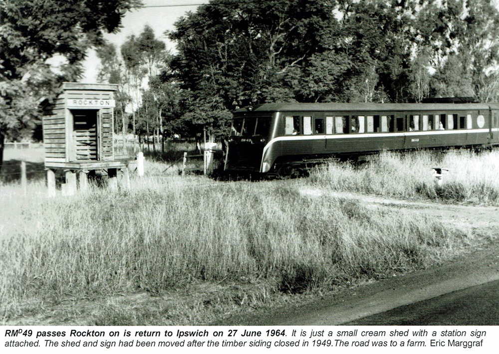
Rockton railway station - 1964 [1]
Utilising Google Maps Lat/Long coordinate search, it places the Rockton railway station at the intersection of Mount Flinders Road along the Boonah-Ipswich Road. It is the turn-off for the Flinders Peak Conservation Park and sections of the Flinders-Goolman Conservation Estate. These parks are used for bushwalking, horse riding, mountain bike riding and camping.

Probable Rockton railway station location
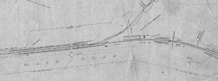
Rockton railway station layout 1922 (QR drawing) [2]
Queensland Railways - Southern & Western - Fassifern Branch - Rockton Station (revised to June 1922)
Revision details from the Queensland Railways drawing as follows:
- 12-09-1949 - (W.N. 37/49) Siding removed
- 01-03-1954 - (W.N. 9/54) - Station site and Cream Shed moved 10C towards Dugandan (New site 11M 11C 47L plain h????)
Peak Crossing railway station
Peak Crossing was served by the Peak Crossing railway station on the Ipswich Boonah Road. It was 12 miles 73 chains (20.8 km) from Ipswich at an elevation of 165 feet (50 m) [27.7789°S 152.7329°E].

Peak Crossing railway station - last train 1964
Utilising Google Maps Lat/Long coordinate search, it places the Peak Crossing railway station just prior to the Peak Crossing State School and Peak Mountain View Park, along the Boonah-Ipswich Road.

Probable Peak Crossing railway station location
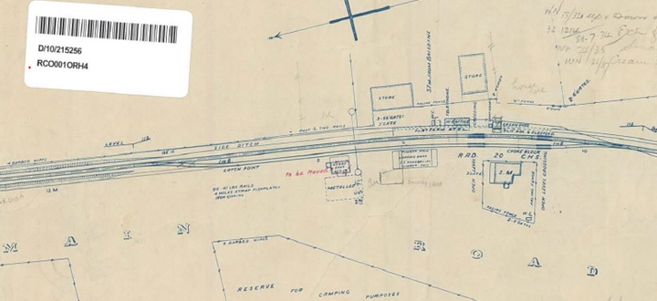
Peak Crossing railway station layout 1922 (QR drawing) [3]
Queensland Railways - Fassifern Branch - Peak Crossing Station (revised to June 1922)
Revision details from the Queensland Railways drawing as follows:
- 15-08-1932 - (W.N. 33/32) Up and Down Home Signals provided
- 31-07-1934 - (32.1214) Extension of Loop Siding 5 Chain Ipswich End
- 10-06-1935 - (W.N. 24/35) Small Trucking Yards (02-07-1935)
- 30-05-1937 - (W.N. 21/37) Cream Shed removed
- 19-07-1950 - (49-449) Approved to provide backroom to Station Master's residence (M3594)
- 11-06-1962 - (W.N. 24/62) Closed as a gate from 29-06-1962
- 02-03-1964 - (W.N. 10/64) Closed to Public Traffic from 01-07-1964
- 09-07-1965 - (62.4952) Approved to move Goods Shed to Gatton
Flinders railway station
Flinders railway station was located on Flinders Road served the area south of Purga Creek. It was 13 miles 72 chains (22.4 km) from Ipswich at an elevation of 247 feet (75m) [27.7886°S 152.7217°E].
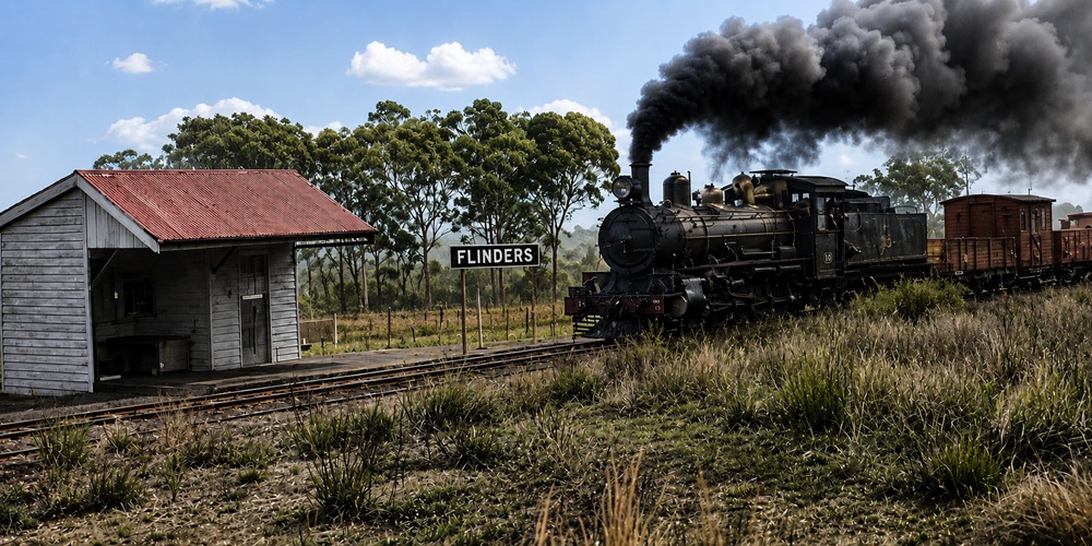
Flinders railway station
Utilising Google Maps Lat/Long coordinate search, it places the Flinders railway station just passed Flinders Dolomite Roads along Flindersd Street (near the Flinders Peak Rural fire brigade).

Probable Flinders railway station location
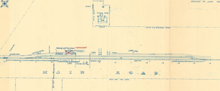
Flinders railway station layout 1922 (QR drawing) [4]
Queensland Railways - Southern & Western - Fassifern Branch - Flinders Station (revised to June 1922)
Revision details from the Queensland Railways drawing as follows:
- 28-03-1960 - (57.3897 Cir. Memo 13/60) Cream Shed removed to Teviotville
- 12-12-1960 - (60/3907 Cir. Memo 50/60) Goods Shed removed
Churchbank railway station
Churchbank railway station was located in Webers Road in the very north of the present day locality of Harrisville on the boundary with Mutdapilly. It was 15 miles 77 chains (25.7 km) from Ipswich at an elevation of 155 feet (47 m) [27.7891°S 152.6916°E].
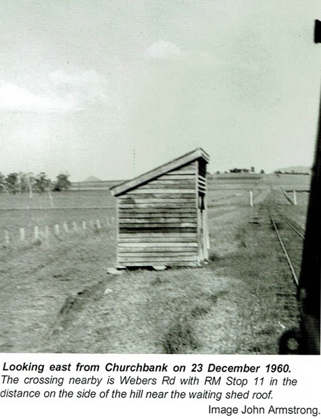
Churchbank railway station - 1960
Utilising Google Maps Lat/Long coordinate search, it places the Churchbank railway station along Webers Rd (near the Mutdapilly Research Station - BQCC Fire Ant Eradication Program).

Probable Churchbank railway station location
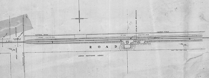
Churchbank railway station layout 1925 (QR drawing) [5]
Queensland Railways - Fassifern Branch - Churchbank Station (revised to May 1925)
Revision details from the Queensland Railways drawing as follows:
- 05-12-1938 - (37-3779) Approved to remove Cream Shed to Fernvale
- 27-02-1939 - (W.N. 9/39) Cream Shed removed
- 02-03-1964 - (W.N. 10/64) Closed to Public Traffic from 01-07-1964
- [1] Look Out for Train: 7 - To The Scenic Rim 1 (page 30)
- [2] S00978-0001 Rockton Station (June 1922) - (view the full version)
- [3] S00979-0001 Peak Crossing Station (June 1922) - (view the full version)
- [4] S00981-0001 Flinders Station (June 1922) - (view the full version)
- [5] S00980-0001 Churchbank Station (May 1925) - (view the full version)