
The Mount Edwards branch line was a historical branch railway in South East Queensland, consisting of the opening from Munbilla to Kalbar and the final extension to Mount Edwards.
Line History
- First section: Opened from Munbilla to Engelsburg (now Kalbar) on 17 April 1916.
- Final completion: Extended to Mount Edwards on 7 October 1922.
- Closure: Shut down completely on 1 November 1960 due to lack of traffic.
- Junction: Branched off the Fassifern (Dugandan) line immediately south of Munbilla station.
The line was intended to form part of a via recta (Latin, "straight route") between Brisbane and Sydney via the break-of-gauge border town of Wallangarra. Before the completion of the New South Wales North Coast Line in 1930, rail traffic between the two state capitals travelled west from Brisbane to Toowoomba then south to Wallangarra via Warwick. The via recta was to incorporate the Mount Edwards line and the Maryvale line on the other side of the Great Dividing Range to produce a direct route southwest from Brisbane to Warwick, shaving around 95 km off the interstate journey. However, the via recta was never completed. [1]
In the map segment below (from the CAD map for Queensland Two Mile Series - 1955) the station locations for Kalbar to Mount Edwards are detailed.
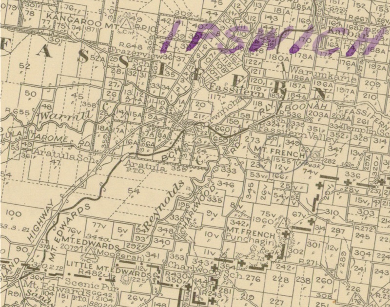
Segment from QLD 2 Mile map - 1955
Mount Edwards railway line stations
The below table (regenerated from wikipedia) details the distances, station names, lat/long coordinates and elevations. On a mobile device the lat/long and elevation data has been removed from view in order to minimise clutter to the table.
| Distance | Name | Lat/Long | Altitude |
|---|---|---|---|
| 23 miles 64 chains (38.3 km) from Ipswich | Munbilla railway station | 27.873611°S 152.657778°E | 278 feet (85 m) |
| Junction with Mount Edwards railway line | 27.87392°S 152.65792°E | ||
| 26 miles 56 chains (43.0 km) from Ipswich | Waraperta railway station | 27.90333°S 152.63278°E | 247 feet (75 m) |
| 29 miles 39 chains (47.5 km) from Ipswich | Kalbar railway station | 27.93924°S 152.62090°E | 262 feet (80 m) |
| 31 miles 34 chains (50.6 km) from Ipswich | Warumkarie railway station | 27.95715°S 152.61082°E | 308 feet (94 m) |
| 32 miles 60 chains (52.7 km) from Ipswich | Fassifern Valley railway station | 27.97297°S 152.59979°E | 295 feet (90 m) |
| 34 miles 30 chains (55.3 km) from Ipswich | Morwincha railway station | 27.97299°S 152.57734°E | 312 feet (95 m) |
| 36 miles 2 chains (58.0 km) from Ipswich | Aratula railway station | 27.98252°S 152.55450°E | 357 feet (109 m) |
| 39 miles 70 chains (64.2 km) from Ipswich | Mount Edwards railway station | 28.02136°S 152.51578°E | 621 feet (189 m) |
Station images
Below are a few images depicting the Mount Edwars Railway Staions:
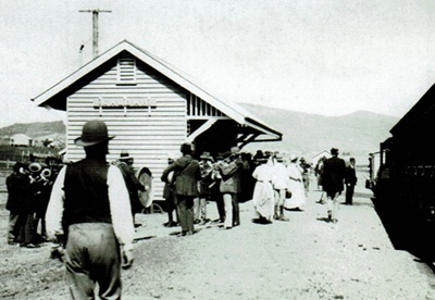
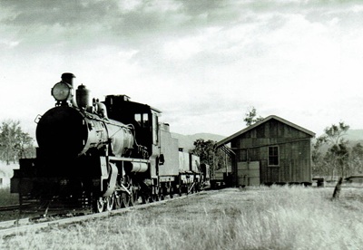
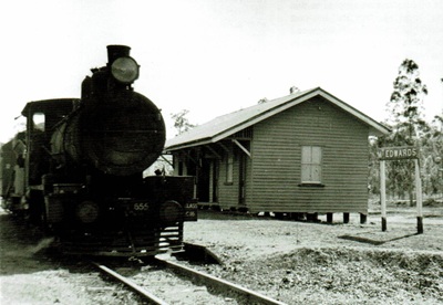
- [1] Wikipedia - Mount Edwards railway line